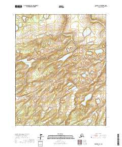
2017 Map of Beaver A-2 SE
USGS Topo · Published 2017About this map
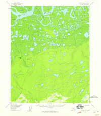
Beaver Lake and Sunken Lake punctuate this high-latitude terrain within the Yukon-Koyukuk Census Area. This region of interior Alaska is defined by a complex mosaic of wetlands and small water bodies that suggests a landscape shaped by thermokarst activity and shifting drainage patterns. The lack of roads or established settlements on this sheet reflects the remote character of the territory, where geography is primarily defined by the township and range lines of t15n r1w, t15n r1e, t14n r1w, and t14n r1e. For researchers of the northern interior, the map provides a precise record of the lake shorelines and elevation contours as they existed in the early twenty-first century.
Find a feature on this map
6 named features on this map. Tap any name to fly to it.
Don’t see what you’re looking for? This feature index may not catch every label — zoom into the map to look around manually.
Map Details
Editions of this 2017 Beaver A-2 SE Map
This is the sole edition of this map. No revisions or reprints were ever made.
Other maps of this area

1945 · Livengood
USGS Topo · 1:250,000

1951 · Livengood
USGS Topo · 1:250,000

1951 · Beaver
USGS Topo · 1:250,000

1952 · Livengood D-2
USGS Topo · 1:63,360

1952 · Livengood D-1
USGS Topo · 1:63,360
1954 · Livengood D-2
USGS Topo · 1:63,360
1954 · Livengood D-1
USGS Topo · 1:63,360
1956 · Beaver A-1
USGS Topo · 1:63,360
1956 · Beaver A-2
USGS Topo · 1:63,360

1956 · Beaver
USGS Topo · 1:250,000