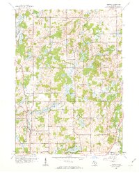
1961 Map of Bedford
USGS Topo · Published 1962About this map
The boundary between BARRY CO and CALHOUN CO defines the landscape of this 1961 revision, where the agricultural plains of southern Michigan meet a dense network of glacial lakes and wetlands. The settlement of Bedford sits near the southern edge, while the smaller hamlets of Lacey and Assyria anchor the northern townships. The area is marked by a high density of rural educational and religious sites, including Bethel Chapel and numerous country schools such as Monroe Sch, Poorman Sch, and Culver Sch.
Find a feature on this map
45 named features on this map. Tap any name to fly to it.
Don’t see what you’re looking for? This feature index may not catch every label — zoom into the map to look around manually.
Map Details
Editions of this 1961 Bedford Map
4 editions found
Other maps of this area

1918 · Battle Creek
USGS Topo · 1:62,500

1918 · Galesburg
USGS Topo · 1:62,500

1943 · Battle Creek
USGS Topo · 1:62,500

1944 · Galesburg
USGS Topo · 1:62,500

1947 · Augusta
USGS Topo · 1:24,000

1947 · Banfield
USGS Topo · 1:24,000

1947 · Bellevue
USGS Topo · 1:24,000

1947 · Bedford
USGS Topo · 1:24,000

1947 · Ceresco
USGS Topo · 1:24,000

1947 · Battle Creek
USGS Topo · 1:24,000