
1910 Map of Bedford
USGS Topo · Published 1910About this map
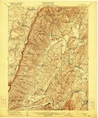
The Allegheny Mountains create a formidable western barrier in this detailed 1910 survey of Bedford County, where small agricultural hamlets and post offices are scattered through the valleys of Dunning Creek and Adams Run. The map illustrates a rural landscape defined by one-room schoolhouses like the Eight Square School and Centennial School, which served the dispersed farming communities. Along the southern edge, the industrial influence of the Pennsylvania RR and the Raystown Branch Juniata River is evident near Manns Choice, where the topography softens into the Pigeon Hills. The presence of numerous mills, such as Mowrys Mills and Fryes Mill, highlights the local water-powered economy. Further north, the intersection of small-town life and early infrastructure is visible at Schellsburg and Pleasantville, providing genealogists a look at the county before the development of major modern highways through these mountain gaps.
Find a feature on this map
86 named features on this map. Tap any name to fly to it.
Don’t see what you’re looking for? This feature index may not catch every label — zoom into the map to look around manually.
Map Details
Editions of this 1910 Bedford Map
4 editions found
Other maps of this area

1900 · Everett
USGS Topo · 1:62,500

1902 · Everett
USGS Topo · 1:62,500

1902 · Ebensburg
USGS Topo · 1:62,500

1902 · Hollidaysburg
USGS Topo · 1:62,500

1903 · Hollidaysburg
USGS Topo · 1:62,500

1904 · Ebensburg
USGS Topo · 1:62,500

1904 · Johnstown
USGS Topo · 1:62,500

1907 · Johnstown
USGS Topo · 1:62,500

1908 · Bedford
USGS Topo · 1:62,500

1914 · Windber
USGS Topo · 1:62,500