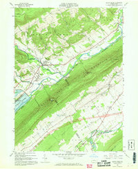
1967 Map of Beech Creek
USGS Topo · Published 1968About this map
Beech Creek and Blanchard sit at a geographic crossroads in the late 1960s, where the winding water of Beech Creek meets the heavy ridges of Bald Eagle Mountain and Beech Creek Mountain. This era is defined by the transformation of the landscape as blue hatching indicates areas slated for submergence by the Blanchard Reservoir, a project fundamentally altering the local terrain. The Penn Central railroad cuts through the gaps, serving established communities like Eagleville and West Beech.
Find a feature on this map
58 named features on this map. Tap any name to fly to it.
Don’t see what you’re looking for? This feature index may not catch every label — zoom into the map to look around manually.
Map Details
Editions of this 1967 Beech Creek Map
3 editions found
Other maps of this area

1921 · Howard
USGS Topo · 1:48,000

1921 · Lock Haven
USGS Topo · 1:62,500

1923 · Howard
USGS Topo · 1:62,500

1923 · Lock Haven
USGS Topo · 1:62,500

1924 · Centre Hall
USGS Topo · 1:62,500

1929 · Centre Hall
USGS Topo · 1:62,500

1937 · Millheim
USGS Topo · 1:48,000

1941 · Millheim
USGS Topo · 1:62,500

1943 · Lewistown
USGS Topo · 1:125,000

1944 · Lock Haven
USGS Topo · 1:62,500