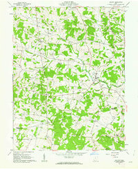
1961 Map of Belfast
USGS Topo · Published 1962About this map
Ohio Brush Creek and its many tributaries, including Lost Fork and Rock Lick Run, carve through this section of Highland and Adams counties. The landscape is dotted with small rural communities like Belfast and Berrysville, while the southern portion features the expansive Tranquility State Wildlife Area. This 1961 field check documents a dense network of family and community burial grounds, such as Walker No 1 Cem, Walker No 2 Cem, and Old Concord Cem, reflecting generations of settlement before modern consolidation. The presence of numerous small churches, including Burnetts Chapel and Zion Ch, underscores the decentralized, agrarian social structure of the mid-20th century. Road patterns emphasize local connectivity between smaller hamlets like Folsom, Fairfax, and Jessup, providing a clear view of the region's character just after the post-war era.
Find a feature on this map
44 named features on this map. Tap any name to fly to it.
Don’t see what you’re looking for? This feature index may not catch every label — zoom into the map to look around manually.
Map Details
Editions of this 1961 Belfast Map
4 editions found
Other maps of this area

1915 · Bainbridge
USGS Topo · 1:48,000

1916 · Peebles
USGS Topo · 1:62,500

1917 · Bainbridge
USGS Topo · 1:62,500

1917 · Hillsboro
USGS Topo · 1:62,500

1918 · Peebles
USGS Topo · 1:62,500

1918 · Seaman
USGS Topo · 1:62,500

1944 · Hillsboro
USGS Topo · 1:62,500

1947 · Columbus
USGS Topo · 1:250,000

1957 · Huntington
USGS Topo · 1:250,000

1960 · Huntington
USGS Topo · 1:250,000