
1958 Map of Belgrade
USGS Topo · Published 1977About this map
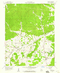
Belgrade and Caledonia anchor this mid-century look at Washington County, where the Ozark landscape transitions from the wooded slopes of the Clark National Forest to the settled valleys of the Big River. The map reveals a community structured around rural education and faith, featuring landmarks like Belgrade Sch, Valley High Sch, and the Pleasant Grove Ch. Local family history is deeply etched into the land through numerous burial grounds, including the Jane Bryan Cem, Bryan Cem, and Davis Cem, providing valuable touchpoints for genealogical research.
Find a feature on this map
33 named features on this map. Tap any name to fly to it.
Don’t see what you’re looking for? This feature index may not catch every label — zoom into the map to look around manually.
Map Details
Editions of this 1958 Belgrade Map
3 editions found
Other maps of this area

1905 · Bonneterre
USGS Topo · 1:62,500

1906 · Potosi
USGS Topo · 1:62,500

1924 · Edgehill
USGS Topo · 1:62,500

1926 · Edgehill
USGS Topo · 1:62,500

1937 · Ironton
USGS Topo · 1:48,000

1945 · Ironton
USGS Topo · 1:62,500

1946 · Ironton
USGS Topo · 1:62,500

1949 · Rolla
USGS Topo · 1:250,000

1953 · Ironton
USGS Topo · 1:62,500

1953 · Rolla
USGS Topo · 1:250,000