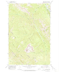
1970 Map of Benchmark
USGS Topo · Published 1973About this map
The Sun River South Fork carves a deep valley through the wilderness of the Lewis and Clark National Forest in this 1970 survey. This area serves as a critical junction for forest management and back-country access, anchored by the Benchmark Work Center and the Benchmark Airfield near the confluence of Straight Creek and Wood Creek. The geography is defined by the Continental Divide, which snakes through the high country past Sugarloaf Mountain and Observation Pass.
Find a feature on this map
31 named features on this map. Tap any name to fly to it.
Don’t see what you’re looking for? This feature index may not catch every label — zoom into the map to look around manually.
Map Details
Editions of this 1970 Benchmark Map
2 editions found
Other maps of this area

1902 · Ovando
USGS Topo · 1:125,000

1903 · Saypo
USGS Topo · 1:125,000

1903 · Coopers Lake
USGS Topo · 1:125,000

1905 · Ovando
USGS Topo · 1:125,000

1936 · Silvertip
USGS Topo · 1:96,000

1942 · Silvertip
USGS Topo · 1:125,000

1955 · Choteau
USGS Topo · 1:250,000

1957 · Choteau
USGS Topo · 1:250,000

1958 · Choteau
USGS Topo · 1:250,000

1958 · Pretty Prairie
USGS Topo · 1:24,000