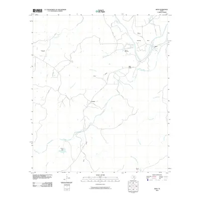
2010 Map of Bend
USGS Topo · Published 2010About this map
Colorado River bends sharply through the San Saba County landscape, anchoring a rural Texas territory defined by intermittent creek beds and small cattle-ranching operations. The settlement of Bend sits nestled against a deep curve of the river, while smaller communities like McAnelly, Chappel, and High Valley are linked by a network of ranch-to-market roads and county routes. The terrain is marked by distinctive elevations such as Round Mountain and the carved paths of Davis Hollow and Whey Hollow.
Find a feature on this map
41 named features on this map. Tap any name to fly to it.
Don’t see what you’re looking for? This feature index may not catch every label — zoom into the map to look around manually.
Map Details
Editions of this 2010 Bend Map
This is the sole edition of this map. No revisions or reprints were ever made.
Other maps of this area

1885 · San Saba
USGS Topo · 1:125,000

1887 · Llano
USGS Topo · 1:125,000

1887 · Lampasas
USGS Topo · 1:125,000

1887 · Burnet
USGS Topo · 1:125,000

1893 · Burnet
USGS Topo · 1:125,000

1894 · Lampasas
USGS Topo · 1:125,000

1894 · San Saba
USGS Topo · 1:125,000

1894 · Llano
USGS Topo · 1:125,000

1903 · Burnet
USGS Topo · 1:125,000

1904 · Llano
USGS Topo · 1:125,000