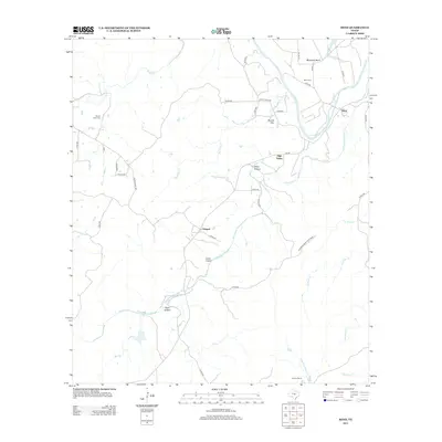
2013 Map of Bend
USGS Topo · Published 2013About this map
The Colorado River carves a deep path through the Texas Hill Country, defining the eastern border of this San Saba and Lampasas county landscape. At the sharpest turn of the river, the settlement of Bend sits near McAnelly Bend, anchored by its local landmarks like the Bend Cem. To the west, the rural community of Chappel serves as a junction for local travel through the rocky terrain. The topography is marked by significant drainages including Cherokee Cr and Bee Cave Cr, which feed the river system across a landscape of named landmarks such as Round Mtn and High Valley. For those interested in the preserved natural history of the region, the northern extent of Colorado Bend State Park is visible along the river's western bank, while family holdings like Barnes Ranch and local sites like Rough Creek Cem speak to the deep-rooted agricultural and ranching history of the area.
Find a feature on this map
43 named features on this map. Tap any name to fly to it.
Don’t see what you’re looking for? This feature index may not catch every label — zoom into the map to look around manually.
Map Details
Editions of this 2013 Bend Map
This is the sole edition of this map. No revisions or reprints were ever made.
Other maps of this area

1885 · San Saba
USGS Topo · 1:125,000

1887 · Llano
USGS Topo · 1:125,000

1887 · Lampasas
USGS Topo · 1:125,000

1887 · Burnet
USGS Topo · 1:125,000

1893 · Burnet
USGS Topo · 1:125,000

1894 · Lampasas
USGS Topo · 1:125,000

1894 · San Saba
USGS Topo · 1:125,000

1894 · Llano
USGS Topo · 1:125,000

1903 · Burnet
USGS Topo · 1:125,000

1904 · Llano
USGS Topo · 1:125,000