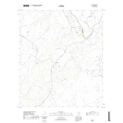
2019 Map of Bend
USGS Topo · Published 2019About this map
The Colorado River carves a dramatic path through the Texas Hill Country on the border of San Saba and Lampasas counties, most notably at the sharp oxbow known as McAnelly Bend. The small settlement of Chappel serves as a central point for the local road network, where Ranch Rd 501 and Co Rd 448 converge. The landscape is defined by deep drainages like Whey Hollow and Davis Hollow, alongside prominent elevations such as Round Mtn. Genealogy researchers will find several localized landmarks, including the Rough Creek Cem near Rough Creek and the Bend Cem positioned on the high ground overlooking the river valley. The eastern portion of the sheet features a complex network of trails and secondary paths, such as the Lively Loop and Tie Slide, winding through the terrain near Gorman Creek.
Find a feature on this map
52 named features on this map. Tap any name to fly to it.
Don’t see what you’re looking for? This feature index may not catch every label — zoom into the map to look around manually.
Map Details
Editions of this 2019 Bend Map
This is the sole edition of this map. No revisions or reprints were ever made.
Other maps of this area

1885 · San Saba
USGS Topo · 1:125,000

1887 · Llano
USGS Topo · 1:125,000

1887 · Lampasas
USGS Topo · 1:125,000

1887 · Burnet
USGS Topo · 1:125,000

1893 · Burnet
USGS Topo · 1:125,000

1894 · Lampasas
USGS Topo · 1:125,000

1894 · San Saba
USGS Topo · 1:125,000

1894 · Llano
USGS Topo · 1:125,000

1903 · Burnet
USGS Topo · 1:125,000

1904 · Llano
USGS Topo · 1:125,000