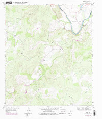
1959 Map of Bend
USGS Topo · Published 1979About this map
The Colorado River winds through the border of San Saba and Lampasas Counties, carving a deep loop known as Mc Anelly Bend. The settlement of Bend sits on the eastern bank, serving as a focal point for the surrounding ranching and farming landscape during the mid-20th century. To the west, the terrain rises into limestone hills and hollows, including the curiously named Glory Hole and the prominent Round Mtn. This period of rural development is marked by established community centers like Chappel and High Valley, alongside family-named landmarks and the Barnes Ranch. The map captures the essential rural infrastructure of the era, from the Rough Creek Ch and its neighboring Rough Creek Cem to the long-reaching Pipeline that cuts across the northern ridges. Water sources like the Artesian Well and numerous creek systems, including Cherokee Creek and Gorman Creek, highlight the geological character of this Central Texas region.
Find a feature on this map
25 named features on this map. Tap any name to fly to it.
Don’t see what you’re looking for? This feature index may not catch every label — zoom into the map to look around manually.
Map Details
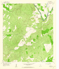
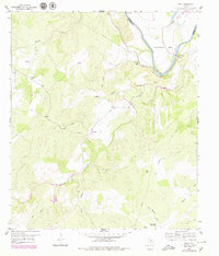
Editions of this 1959 Bend Map
3 editions found
Other maps of this area

1885 · San Saba
USGS Topo · 1:125,000

1887 · Llano
USGS Topo · 1:125,000

1887 · Lampasas
USGS Topo · 1:125,000

1887 · Burnet
USGS Topo · 1:125,000

1893 · Burnet
USGS Topo · 1:125,000

1894 · Lampasas
USGS Topo · 1:125,000

1894 · San Saba
USGS Topo · 1:125,000

1894 · Llano
USGS Topo · 1:125,000

1903 · Burnet
USGS Topo · 1:125,000

1904 · Llano
USGS Topo · 1:125,000