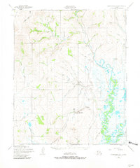
1950 Map of Bendeleben B-6
USGS Topo · Published 1981About this map
Placer Gold Mining Area activity defines the mid-century landscape of this Seward Peninsula interior, where the extraction of resources shaped remote outposts. Centered on the confluence of the Kougarok River and Kuzitrin River, the region is marked by a network of Winter Trails and Tractor Trails that connected isolated settlements like Dahl and Kougarok. The presence of a Roadhouse near Mauze Gulch and the Dahl Landing Strip highlights the infrastructure required for transport and survival in this Alaskan wilderness before the advent of modern highways. Family and locational names appear across the drainage basins, from Coffee Dome to the distinctive Brakes Bottom, tracing the reach of prospectors and early settlers through numerous tributaries including Coarse Gold Creek and Coffee Creek.
Find a feature on this map
43 named features on this map. Tap any name to fly to it.
Don’t see what you’re looking for? This feature index may not catch every label — zoom into the map to look around manually.
Map Details
Editions of this 1950 Bendeleben B-6 Map
3 editions found
Other maps of this area

1950 · Bendeleben C-5
USGS Topo · 1:63,360

1950 · Bendeleben A-6
USGS Topo · 1:63,360

1950 · Bendeleben B-5
USGS Topo · 1:63,360

1950 · Bendeleben B-6
USGS Topo · 1:63,360

1950 · Bendeleben A-5
USGS Topo · 1:63,360

1950 · Bendeleben C-6
USGS Topo · 1:63,360

1950 · Teller
USGS Topo · 1:250,000

1950 · Bendeleben
USGS Topo · 1:250,000

1950 · Teller A-1
USGS Topo · 1:63,360

1950 · Teller B-1
USGS Topo · 1:63,360