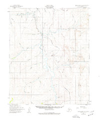
1950 Map of Bendeleben C-6
USGS Topo · Published 1977About this map
Taylor and the nearby settlement of Homestake anchor this 1950 survey of the Seward Peninsula, captured at a time when mining operations and hydraulic engineering shaped the landscape. The Kougarok River serves as the central artery for the region, flanked by the complex path of the North Star Ditch, a significant piece of water-conveyance infrastructure designed to support placer mining. The industrial footprint of the era is evident through numerous Mine symbols and extensive Tailings along the creek beds, particularly near Macklin Cr and Washington Creek.
Find a feature on this map
57 named features on this map. Tap any name to fly to it.
Don’t see what you’re looking for? This feature index may not catch every label — zoom into the map to look around manually.
Map Details
Editions of this 1950 Bendeleben C-6 Map
2 editions found
Other maps of this area

1950 · Bendeleben C-5
USGS Topo · 1:63,360

1950 · Bendeleben B-5
USGS Topo · 1:63,360

1950 · Bendeleben B-6
USGS Topo · 1:63,360

1950 · Bendeleben C-6
USGS Topo · 1:63,360

1950 · Bendeleben D-6
USGS Topo · 1:63,360

1950 · Teller
USGS Topo · 1:250,000

1950 · Bendeleben D-5
USGS Topo · 1:63,360

1950 · Bendeleben
USGS Topo · 1:250,000

1950 · Teller B-1
USGS Topo · 1:63,360

1950 · Teller D-1
USGS Topo · 1:63,360