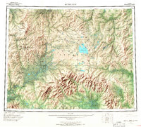
1950 Map of Bendeleben
USGS Topo · Published 1967About this map
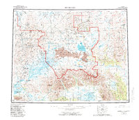
The Seward Peninsula landscape is defined by its volatile volcanic history and its early 20th-century mining economy. Volcanic cones like Dryas Cone and Camille Cone punctuate the central plateau, while the Bendeleben Mountains and Kigluaik Mountains rise sharply in the south. The region's industrial footprint is visible through the Seward Peninsula RR and isolated outposts such as Taylor and Dahl. Geologic activity is further evidenced by the Serpentine Hot Springs and Pilgrim Springs, which provided rare thermal landmarks for early travelers. The northeastern corner of the map reveals the Chicago Creek Coal Mines, a vital energy source for the region's remote operations. This survey also records numerous landing areas and tractor trails that were essential for movement before modern infrastructure, connecting camps like Camp 19 and Camp Haven across the vast drainage basins of the Kugruk River and Fish River.
Find a feature on this map
64 named features on this map. Tap any name to fly to it.
Don’t see what you’re looking for? This feature index may not catch every label — zoom into the map to look around manually.
Map Details
Editions of this 1950 Bendeleben Map
6 editions found

Other maps of this area

1907 · Casadepaga
USGS Topo · 1:62,500

1948 · Norton Bay
USGS Topo · 1:250,000

1950 · Kotzebue A-1
USGS Topo · 1:63,360

1950 · Bendeleben C-5
USGS Topo · 1:63,360

1950 · Bendeleben A-6
USGS Topo · 1:63,360

1950 · Bendeleben B-5
USGS Topo · 1:63,360

1950 · Bendeleben A-4
USGS Topo · 1:63,360

1950 · Bendeleben C-1
USGS Topo · 1:63,360

1950 · Bendeleben C-3
USGS Topo · 1:63,360

1950 · Bendeleben B-6
USGS Topo · 1:63,360