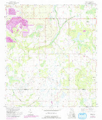
1956 Map of Bereah
USGS Topo · Published 1993About this map
Industrial extraction and rural congregation define this landscape on the border of Polk and Hardee Counties. The northwest corner is dominated by phosphate mining operations, including the Old Colony Mine and extensive Reclaimed Strip Mine areas, illustrating the region's mid-century economic reliance on land transformation. Outside the mining zones, the terrain is characterized by a dense network of watercourses and wetlands, with Bowlegs Creek and Charlie Creek draining through low-lying areas. Small community centers are anchored by local landmarks such as Mt Zion Ch and Eden Cem. The settlement of Bereah sits near the eastern edge, supported by Athens Ch, reflecting the sparse but established social fabric of this interior Florida region during the 1950s.
Find a feature on this map
16 named features on this map. Tap any name to fly to it.
Don’t see what you’re looking for? This feature index may not catch every label — zoom into the map to look around manually.
Map Details
Editions of this 1956 Bereah Map
4 editions found
Other maps of this area

1952 · Homeland
USGS Topo · 1:24,000

1952 · Babson Park
USGS Topo · 1:24,000

1953 · Frostproof
USGS Topo · 1:24,000

1953 · Avon Park
USGS Topo · 1:24,000

1955 · Bowling Green
USGS Topo · 1:24,000

1955 · Wauchula
USGS Topo · 1:24,000

1955 · Alturas
USGS Topo · 1:24,000

1956 · Bereah
USGS Topo · 1:24,000

1956 · Griffins Corner
USGS Topo · 1:24,000

1956 · Fort Pierce
USGS Topo · 1:250,000