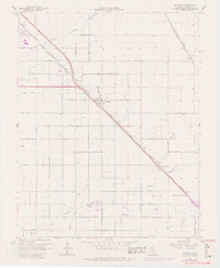
1961 Map of Berenda
USGS Topo · Published 1981About this map
Agricultural development and early irrigation infrastructure define this section of the San Joaquin Valley near the Chowchilla Corp Bdy. The community of Fairmead serves as a central hub, situated along the Southern Pacific rail line and Fairmead Boulevard. The landscape is characterized by a precise grid of avenues and the presence of the Califa Canal, illustrating the region's managed water systems.
Find a feature on this map
33 named features on this map. Tap any name to fly to it.
Don’t see what you’re looking for? This feature index may not catch every label — zoom into the map to look around manually.
Map Details
Editions of this 1961 Berenda Map
4 editions found
Other maps of this area

1916 · Berenda
USGS Topo · 1:31,680

1918 · Chowchilla
USGS Topo · 1:31,680

1918 · Berenda
USGS Topo · 1:31,680

1918 · La Grand
USGS Topo · 1:31,680

1919 · Plainsberg
USGS Topo · 1:31,680

1919 · Raynor Creek
USGS Topo · 1:31,680

1920 · Kismet
USGS Topo · 1:31,680

1920 · Bonita Ranch
USGS Topo · 1:31,680

1921 · Bonita Ranch
USGS Topo · 1:31,680

1922 · Kentucky Well
USGS Topo · 1:31,680