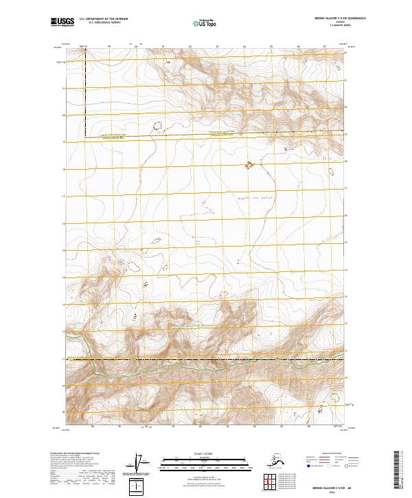
2024 Map of Bering Glacier C-5 SW
USGS Topo · Published 2024About this map
Bagley Ice Valley dominates the high-altitude landscape of this 2024 survey, illustrating the massive ice fields that feed the Bering Glacier system. Located within the Wrangell-Saint Elias National Park and the adjacent Wrangell-St. Elias Wilderness, the topography is defined by significant ice movement and glacial features. To the south, the terrain rises toward Waxell Ridge, where sharp contours delineate the boundary between major ice flows and the rugged mountain backbone. This map serves as a modern record of one of the most active glacial regions in North America, where the confluence of administrative boundaries like the Yakutat Borough and Copper River Census Area meets a landscape essentially untouched by human infrastructure.
Find a feature on this map
13 named features on this map. Tap any name to fly to it.
Don’t see what you’re looking for? This feature index may not catch every label — zoom into the map to look around manually.
Map Details
Editions of this 2024 Bering Glacier C-5 SW Map
This is the sole edition of this map. No revisions or reprints were ever made.
Other maps of this area

1950 · Bering Glacier
USGS Topo · 1:250,000

1951 · Bering Glacier
USGS Topo · 1:250,000

1959 · Bering Glacier
USGS Topo · 1:250,000
1985 · Bering Glacier B-5
USGS Topo · 1:63,360
1985 · Bering Glacier B-6
USGS Topo · 1:63,360
1985 · Bering Glacier C-5
USGS Topo · 1:63,360
1985 · Bering Glacier C-6
USGS Topo · 1:63,360
2016 · Bering Glacier B-5 NE
USGS Topo · 1:25,000
2016 · Bering Glacier C-5 NE
USGS Topo · 1:25,000
2016 · Bering Glacier C-5 SE
USGS Topo · 1:25,000