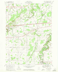
1969 Map of Berlin Heights
USGS Topo · Published 1971About this map
Berlin Heights and Wakeman anchor this late-1960s survey of the north Ohio landscape where the agriculture of the Firelands meets the industrial transport corridors of the Ohio Turnpike and several major railroads. The winding Vermilion River carves a deep valley in the southeast corner near Wakeman, while smaller watercourses like Old Woman Creek and Chappel Creek drain northward toward Lake Erie. This era shows the region in transition, where established rail lines like the Norfolk and Western and Penn Central still serve rural hubs such as Berlin Heights Station and Collins.
Find a feature on this map
34 named features on this map. Tap any name to fly to it.
Don’t see what you’re looking for? This feature index may not catch every label — zoom into the map to look around manually.
Map Details
Editions of this 1969 Berlin Heights Map
3 editions found
Other maps of this area

1903 · Vermilion
USGS Topo · 1:62,500

1904 · Sandusky
USGS Topo · 1:62,500

1908 · New London
USGS Topo · 1:62,500

1915 · Norwalk
USGS Topo · 1:62,500

1944 · Norwalk
USGS Topo · 1:62,500

1956 · Toledo
USGS Topo · 1:250,000

1959 · Milan
USGS Topo · 1:24,000

1959 · Berlin Heights
USGS Topo · 1:24,000

1959 · Vermilion East
USGS Topo · 1:24,000

1959 · Vermilion West
USGS Topo · 1:24,000