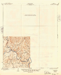
1932 Map of Bertram
USGS Topo · Published 1949About this map
The Colorado River carves a deep path through Burnet County in this early 1930s survey, a period when the river was still crossed at traditional low-water points like Pangle Crossing and Singleton Crossing. The settlement of Smithwick serves as a local hub amidst a landscape defined by rugged topography and numerous watercourses, including Hamilton Creek and Doublehorn Creek. This map reflects a rural Texas community structured around small local institutions, with Hale Ch and Rockvale Ch providing social centers alongside schools such as Pleasant Valley Sch and Doublehorn Sch. Notable terrain features like Wildcat Mtn rise above the drainage basins of Postoak Creek and Alligator Creek, illustrating the natural barriers that dictated early road patterns and land use in the Highland Lakes region before major dam projects reshaped the river valley.
Find a feature on this map
19 named features on this map. Tap any name to fly to it.
Don’t see what you’re looking for? This feature index may not catch every label — zoom into the map to look around manually.
Map Details
Editions of this 1932 Bertram Map
2 editions found

Other maps of this area

1887 · Blanco
USGS Topo · 1:125,000

1887 · Burnet
USGS Topo · 1:125,000

1893 · Georgetown
USGS Topo · 1:125,000

1893 · Burnet
USGS Topo · 1:125,000

1894 · Blanco
USGS Topo · 1:125,000

1896 · Austin
USGS Topo · 1:125,000

1897 · Austin
USGS Topo · 1:125,000

1903 · Burnet
USGS Topo · 1:125,000

1909 · Burnet
USGS Topo · 1:125,000

1910 · Austin
USGS Topo · 1:125,000