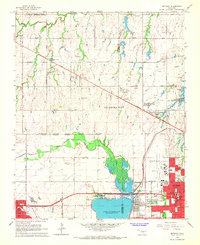
1966 Map of Bethany
USGS Topo · Published 1967About this map
Lake Overholser and the North Canadian River dominate the southern portion of this mid-1960s survey, marking a distinct boundary between the expanding suburbs of Oklahoma City and the rural outskirts of Yukon. The landscape reveals a period of significant institutional growth, anchored by Bethany College, the St Francis DeSales Seminary, and multiple schools like Harris Sch and Overholser Sch. Civil aviation is well-represented by the Wiley Post Airport and smaller private facilities including Richards Landing Strip and Yukon Landing Strip. Residential pockets like Warr Acres and Woodlawn Park show the mid-century suburbanization of the region, while the northern sections remain largely open with numerous Oil Wells and Gravel Pits indicating the local extractive economy. The presence of specialized sites like the Orphanage, Childrens Hosp, and Retirement Community suggests a maturing social infrastructure in the Bethany area during this era.
Find a feature on this map
64 named features on this map. Tap any name to fly to it.
Don’t see what you’re looking for? This feature index may not catch every label — zoom into the map to look around manually.
Map Details
Editions of this 1966 Bethany Map
3 editions found
Other maps of this area

1892 · Kingfisher
USGS Topo · 1:125,000

1893 · Oklahoma City
USGS Topo · 1:62,500

1893 · Minco
USGS Topo · 1:62,500

1895 · Kingfisher
USGS Topo · 1:125,000

1904 · Chickasha
USGS Topo · 1:125,000

1951 · Britton
USGS Topo · 1:24,000

1954 · Oklahoma City
USGS Topo · 1:250,000

1956 · Oklahoma City
USGS Topo · 1:24,000

1956 · Oklahoma City
USGS Topo · 1:62,500

1957 · Oklahoma City
USGS Topo · 1:250,000