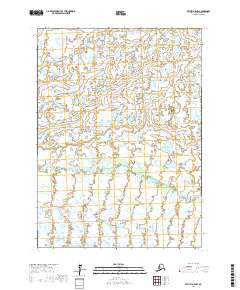
2017 Map of Bethel A-6 NW
USGS Topo · Published 2017About this map
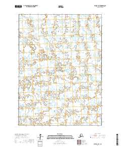
Eek River meanders across this low-lying Alaskan landscape, defining the primary drainage pattern of this subarctic wilderness. The terrain is characterized by a high density of small ponds and wetlands, typical of the Yukon-Kuskokwim Delta region. The lack of roads or permanent settlements within the survey area reflects the remote nature of the territory during this period, with the landscape remaining largely dominated by natural hydrological processes and seasonal shifts. Surveyed boundaries for township and range, such as t1n r69w and t2n r68w, provide the only formal human overlay on this otherwise pristine coastal plain environment.
Find a feature on this map
5 named features on this map. Tap any name to fly to it.
Don’t see what you’re looking for? This feature index may not catch every label — zoom into the map to look around manually.
Map Details
Editions of this 2017 Bethel A-6 NW Map
This is the sole edition of this map. No revisions or reprints were ever made.
Other maps of this area

1950 · Bethel
USGS Topo · 1:250,000

1954 · Bethel B-6
USGS Topo · 1:63,360

1954 · Bethel B-7
USGS Topo · 1:63,360

1954 · Bethel A-7
USGS Topo · 1:63,360

1954 · Bethel A-6
USGS Topo · 1:63,360
1964 · Bethel A-6
USGS Topo · 1:63,360

1980 · Bethel
USGS Topo · 1:250,000
2017 · Bethel B-6 SW
USGS Topo · 1:25,000
2017 · Bethel B-7 SE
USGS Topo · 1:25,000
2017 · Bethel A-7 SE
USGS Topo · 1:25,000