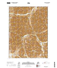
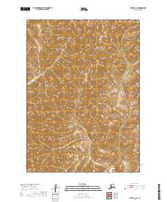
2019 Map of Bethel B-3 NW
USGS Topo · Published 2019About this map
The Kilbuck Mountains dominate this 2019 survey, defining a landscape carved by a series of significant drainage systems in southwest Alaska. The Kisaralik River and Kasigluk River flow through the southern and central portions of the quadrangle, illustrating the complex hydrology of the Bethel census area. These rivers, along with tributaries like Quicksilver Creek and Swift Cr, represent the primary natural corridors through the high relief of the Kilbucks.
Find a feature on this map
12 named features on this map. Tap any name to fly to it.
Don’t see what you’re looking for? This feature index may not catch every label — zoom into the map to look around manually.
Map Details
Editions of this 2019 Bethel B-3 NW Map
This is the sole edition of this map. No revisions or reprints were ever made.
Other maps of this area

1950 · Bethel
USGS Topo · 1:250,000

1954 · Bethel C-4
USGS Topo · 1:63,360

1954 · Bethel C-3
USGS Topo · 1:63,360

1954 · Bethel B-3
USGS Topo · 1:63,360

1954 · Bethel B-4
USGS Topo · 1:63,360

1980 · Bethel
USGS Topo · 1:250,000
2017 · Bethel B-4 NE
USGS Topo · 1:25,000
2017 · Bethel C-4 SE
USGS Topo · 1:25,000
2017 · Bethel B-4 SE
USGS Topo · 1:25,000
2019 · Bethel C-3 SE
USGS Topo · 1:25,000