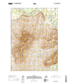
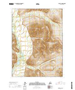
2017 Map of Bethel C-4 NW
USGS Topo · Published 2017About this map
Kisaralik River meanders through this portion of the Bethel Census Area, defining a landscape shaped by glacial and fluvial action. The waterway cuts through the northern and southern corners of the sheet, providing a stark contrast to the prominent elevation of Nukluk Mtn which dominates the central-western terrain. This 2017 survey by the U.S. Geological Survey maps a region characterized by complex drainage patterns, with smaller tributaries like Nukluk Cr feeding into the larger river systems. The absence of roads or established settlements on the map underscores the area's isolation, where land use is defined primarily by the natural topography and the Public Land Survey System grids of Township 7 North and Township 8 North. For researchers or cartography enthusiasts, the map provides a high-resolution view of the intricate contours and wetland fringes that define this subarctic wilderness.
Find a feature on this map
9 named features on this map. Tap any name to fly to it.
Don’t see what you’re looking for? This feature index may not catch every label — zoom into the map to look around manually.
Map Details
Editions of this 2017 Bethel C-4 NW Map
This is the sole edition of this map. No revisions or reprints were ever made.
Other maps of this area

1950 · Bethel
USGS Topo · 1:250,000

1954 · Bethel D-4
USGS Topo · 1:63,360

1954 · Bethel C-5
USGS Topo · 1:63,360

1954 · Bethel C-4
USGS Topo · 1:63,360

1954 · Bethel D-5
USGS Topo · 1:63,360

1980 · Bethel
USGS Topo · 1:250,000
2017 · Bethel C-4 SW
USGS Topo · 1:25,000
2017 · Bethel C-4 SE
USGS Topo · 1:25,000
2017 · Bethel C-5 NE
USGS Topo · 1:25,000
2017 · Bethel C-4 NE
USGS Topo · 1:25,000