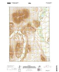
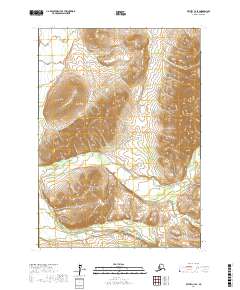
2017 Map of Bethel C-4 SW
USGS Topo · Published 2017About this map
Spein Mtn dominates the northern landscape of this Bethel Census Area quadrant, its high elevations rising sharply between the river drainage systems of the Yukon-Kuskokwim Delta region. The Kasigluk River winds through the southwestern and central portions of the sheet, characterized by the complex, meandering patterns typical of Alaskan glacial-fed rivers. To the east, the Kisaralik River enters the frame, joined by the smaller Quartz Cr as they cut through the shifting alluvial plains. The terrain here is defined by these watercourses and the relief of the Kilbuck Mountains, illustrating the remote and rugged interior of Southwest Alaska as it was documented in 2017. This survey provides a precise record of the hydrography and elevation before any significant modern shifts in these sensitive river channels.
Find a feature on this map
8 named features on this map. Tap any name to fly to it.
Don’t see what you’re looking for? This feature index may not catch every label — zoom into the map to look around manually.
Map Details
Editions of this 2017 Bethel C-4 SW Map
This is the sole edition of this map. No revisions or reprints were ever made.
Other maps of this area

1950 · Bethel
USGS Topo · 1:250,000

1954 · Bethel C-5
USGS Topo · 1:63,360

1954 · Bethel C-4
USGS Topo · 1:63,360

1954 · Bethel B-4
USGS Topo · 1:63,360

1954 · Bethel B-5
USGS Topo · 1:63,360

1980 · Bethel
USGS Topo · 1:250,000
2017 · Bethel B-4 NW
USGS Topo · 1:25,000
2017 · Bethel B-4 NE
USGS Topo · 1:25,000
2017 · Bethel C-4 NW
USGS Topo · 1:25,000
2017 · Bethel C-4 SE
USGS Topo · 1:25,000