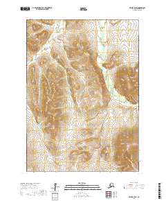
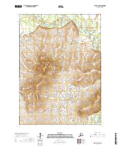
2017 Map of Bethel C-5 SE
USGS Topo · Published 2017About this map
The Little Kasigluk River winds through this subarctic landscape, carving a complex network of meanders across the marshy lowlands. This terrain is characterized by extensive wetlands and an intricate drainage pattern typical of the Yukon-Kuskokwim Delta region. Rising above the flat, saturated river valleys, Shining Dome serves as a prominent navigational landmark for those traversing the interior. The contrast between the high relief of the dome and the low-lying Kasigluk River highlights the varied topography of this remote Alaskan territory, where seasonal water flow and permafrost dictate the shape of the land. This survey provides an essential view of the hydrography and elevation before any modern infrastructure altered the natural path of these waterways.
Find a feature on this map
7 named features on this map. Tap any name to fly to it.
Don’t see what you’re looking for? This feature index may not catch every label — zoom into the map to look around manually.
Map Details
Editions of this 2017 Bethel C-5 SE Map
This is the sole edition of this map. No revisions or reprints were ever made.
Other maps of this area

1950 · Bethel
USGS Topo · 1:250,000

1954 · Bethel C-5
USGS Topo · 1:63,360

1954 · Bethel C-4
USGS Topo · 1:63,360

1954 · Bethel B-4
USGS Topo · 1:63,360

1954 · Bethel B-5
USGS Topo · 1:63,360

1980 · Bethel
USGS Topo · 1:250,000
2017 · Bethel B-4 NW
USGS Topo · 1:25,000
2017 · Bethel B-5 NW
USGS Topo · 1:25,000
2017 · Bethel C-4 SW
USGS Topo · 1:25,000
2017 · Bethel C-4 NW
USGS Topo · 1:25,000