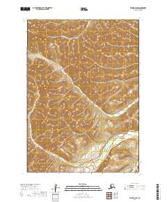
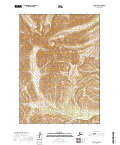
2019 Map of Bethel D-2 SW
USGS Topo · Published 2019About this map
The Salmon River flows through the southern portion of this landscape, carving a low-elevation corridor through the higher elevations of the Bethel Census Area. The terrain is defined by a series of branching drainages, including Wilhelmina Cr in the north and Fisher Cr which winds through the central and eastern sections. In the southeast corner, Cripple Cr joins the larger drainage network. This 2019 survey illustrates the intricate hydrography of the region as it existed in the early 21st century, showing how the natural flow of water dictates the topography in an area largely devoid of human-made infrastructure or established road networks. The map provides a clear look at the undeveloped watershed before any modern alterations or large-scale developments.
Find a feature on this map
8 named features on this map. Tap any name to fly to it.
Don’t see what you’re looking for? This feature index may not catch every label — zoom into the map to look around manually.
Map Details
Editions of this 2019 Bethel D-2 SW Map
This is the sole edition of this map. No revisions or reprints were ever made.
Other maps of this area

1950 · Bethel
USGS Topo · 1:250,000

1954 · Bethel C-3
USGS Topo · 1:63,360

1954 · Bethel D-3
USGS Topo · 1:63,360

1979 · Bethel D-2
USGS Topo · 1:63,360

1979 · Bethel C-2
USGS Topo · 1:63,360

1980 · Bethel
USGS Topo · 1:250,000
2019 · Bethel C-2 NE
USGS Topo · 1:25,000
2019 · Bethel D-3 SE
USGS Topo · 1:25,000
2019 · Bethel D-3 NE
USGS Topo · 1:25,000
2019 · Bethel D-2 NW
USGS Topo · 1:25,000