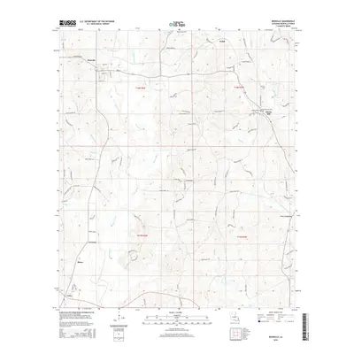
2015 Map of Bienville
USGS Topo · Published 2015About this map
Saline Bayou and its many tributaries, including Hurricane Cr and Edwards Mill Cr, create a dense network of waterways across this Bienville Parish landscape. Small settlements and named crossroads define the human geography, with Bienville serving as a primary hub alongside smaller locales like Liberty Hill, Cox Crossing, and Lucky. The eastern portion of the map is particularly significant for genealogical research, containing the Old Liberty Hill Cem, Liberty Hill Cem, and Taylor Cem. A complex system of parish roads, such as Parish Road 90 and Taylor Cemetery Rd, connects these rural communities through a terrain of shifting elevations and winding creeks like Sixmile Cr. This 2015 survey provides a modern snapshot of traditional North Louisiana settlement patterns, where timberlands and creek-bottoms remain central to the local geography.
Find a feature on this map
89 named features on this map. Tap any name to fly to it.
Don’t see what you’re looking for? This feature index may not catch every label — zoom into the map to look around manually.
Map Details
Editions of this 2015 Bienville Map
This is the sole edition of this map. No revisions or reprints were ever made.
Other maps of this area

1947 · Goldonna
USGS Topo · 1:62,500

1947 · Ashland
USGS Topo · 1:62,500

1947 · Bienville
USGS Topo · 1:62,500

1948 · Jamestown
USGS Topo · 1:62,500

1949 · Jamestown
USGS Topo · 1:62,500

1949 · Bienville
USGS Topo · 1:62,500

1955 · Shreveport
USGS Topo · 1:250,000

1956 · Shreveport
USGS Topo · 1:250,000

1957 · Goldonna
USGS Topo · 1:62,500

1957 · Ashland
USGS Topo · 1:62,500