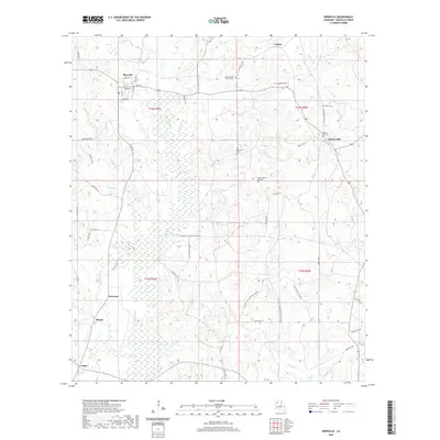
2020 Map of Bienville
USGS Topo · Published 2020About this map
Saline Bayou and its associated wetlands dominate the central portion of this landscape, carving a wide corridor through the terrain of Bienville Parish. The village of Bienville occupies the northwestern corner, defined by a tidy grid of streets including Main St and Spruce St, while the community of Liberty Hill anchors the eastern edge. This modern digital survey reflects a landscape deeply influenced by recreational land use and family history, evidenced by a high density of private hunting clubs such as the Cotton Patch Hunting Club Rd and XYZ Hunting Club Rd. Genealogists will find a wealth of data in the numerous rural burial grounds, ranging from the Mount Zillah Church Cem and Mount Zillah Old Cem to the New Raspberry Cem and Taylor Cem, which mark the sites of early local congregations and family settlements.
Find a feature on this map
61 named features on this map. Tap any name to fly to it.
Don’t see what you’re looking for? This feature index may not catch every label — zoom into the map to look around manually.
Map Details
Editions of this 2020 Bienville Map
This is the sole edition of this map. No revisions or reprints were ever made.
Other maps of this area

1947 · Goldonna
USGS Topo · 1:62,500

1947 · Ashland
USGS Topo · 1:62,500

1947 · Bienville
USGS Topo · 1:62,500

1948 · Jamestown
USGS Topo · 1:62,500

1949 · Jamestown
USGS Topo · 1:62,500

1949 · Bienville
USGS Topo · 1:62,500

1955 · Shreveport
USGS Topo · 1:250,000

1956 · Shreveport
USGS Topo · 1:250,000

1957 · Goldonna
USGS Topo · 1:62,500

1957 · Ashland
USGS Topo · 1:62,500