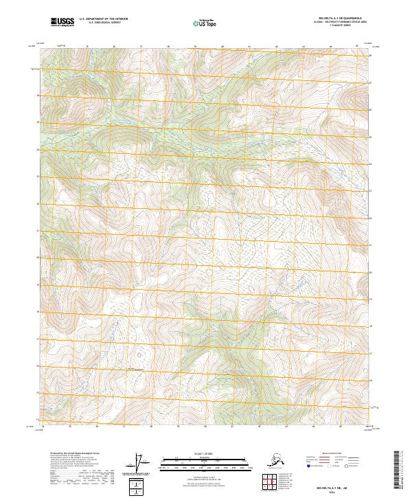
2024 Map of Big Delta A-1 NE
USGS Topo · Published 2024About this map
The Mertie Mountains dominate the southern landscape of this 2024 USGS survey, giving way to a network of high-latitude waterways that define the drainage of the interior. The South Fork Goodpaster River meanders across the northern half of the sheet, carving a path through the subarctic terrain where Divide Creek joins from the north. The absence of road infrastructure or named settlements highlights the topographical focus of this contemporary data, emphasizing the primary natural boundaries of the Volkmar River system. The map serves as a precise record of hydrologic patterns and elevation contours in the Southeast Fairbanks region, capturing the intricate relationship between the mountain slopes and the river valleys that remain central to Alaskana navigation and land management.
Find a feature on this map
10 named features on this map. Tap any name to fly to it.
Don’t see what you’re looking for? This feature index may not catch every label — zoom into the map to look around manually.
Map Details
Editions of this 2024 Big Delta A-1 NE Map
This is the sole edition of this map. No revisions or reprints were ever made.
Other maps of this area

1950 · Big Delta
USGS Topo · 1:250,000

1951 · Big Delta
USGS Topo · 1:250,000

1951 · Eagle
USGS Topo · 1:250,000

1955 · Big Delta A-1
USGS Topo · 1:63,360

1956 · Eagle A-6
USGS Topo · 1:63,360

1956 · Eagle B-6
USGS Topo · 1:63,360

1957 · Eagle
USGS Topo · 1:250,000

1958 · Big Delta B-1
USGS Topo · 1:63,360

1958 · Big Delta
USGS Topo · 1:250,000
2018 · Big Delta B-1 SW
USGS Topo · 1:25,000