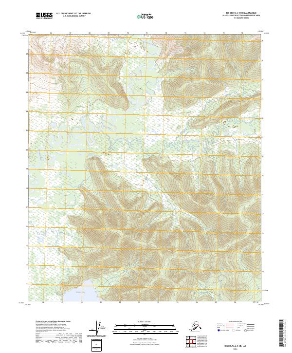
2024 Map of Big Delta A-3 NE
USGS Topo · Published 2024About this map
Goodpaster River and the South Fork Goodpaster River dominate this interior Alaskan landscape in the Southeast Fairbanks Census Area. The map captures a complex drainage system where the primary river and its tributaries, such as White Creek and Sand Creek, wind through a region defined by significant elevation changes and wetland pockets. In the southern portion of the quadrangle, Volkmar Lake serves as a prominent landmark, situated near the boundary of t9s r13e. The presence of Liscum Slough further illustrates the hydrological complexity of the river valley. This 2024 edition, which utilizes hydrography data spanning back to 2002, provides a modern spatial reference for this remote territory, highlighting the natural geography before any significant human infrastructure or named settlements have altered the terrain.
Find a feature on this map
10 named features on this map. Tap any name to fly to it.
Don’t see what you’re looking for? This feature index may not catch every label — zoom into the map to look around manually.
Map Details
Editions of this 2024 Big Delta A-3 NE Map
This is the sole edition of this map. No revisions or reprints were ever made.
Other maps of this area

1950 · Big Delta
USGS Topo · 1:250,000

1951 · Big Delta
USGS Topo · 1:250,000

1954 · Big Delta A-2
USGS Topo · 1:63,360

1955 · Big Delta A-3
USGS Topo · 1:63,360

1955 · Big Delta A-2
USGS Topo · 1:63,360

1958 · Big Delta B-3
USGS Topo · 1:63,360

1958 · Big Delta B-2
USGS Topo · 1:63,360

1958 · Big Delta
USGS Topo · 1:250,000
2016 · Big Delta B-3 SE
USGS Topo · 1:25,000
2016 · Big Delta A-3 NW
USGS Topo · 1:25,000