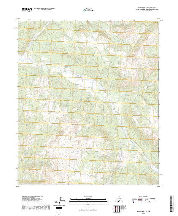
2024 Map of Big Delta B-1 NE
USGS Topo · Published 2024About this map
Goodpaster River and its major tributary, the Eisenmenger Fork, dominate this interior Alaskan landscape in the Southeast Fairbanks region. The drainage network is dense and complex, with several prominent creeks including Boulder Creek and Granite Creek feeding into the larger water systems. This 2024 USGS survey highlights a remote wilderness area defined by its hydrology, where the Wolverine Creek flows in the southwestern reaches. The map clearly delineates the township and range boundaries for t5s r18e, t5s r19e, t6s r18e, and t6s r19e, providing a precise spatial framework for this unpopulated terrain. The lack of named settlements or roads underscores the pristine nature of the river corridors as they navigate the high-elevation contours of the Big Delta quadrangle.
Find a feature on this map
9 named features on this map. Tap any name to fly to it.
Don’t see what you’re looking for? This feature index may not catch every label — zoom into the map to look around manually.
Map Details
Editions of this 2024 Big Delta B-1 NE Map
This is the sole edition of this map. No revisions or reprints were ever made.
Other maps of this area

1950 · Big Delta
USGS Topo · 1:250,000

1951 · Big Delta
USGS Topo · 1:250,000

1951 · Eagle
USGS Topo · 1:250,000

1956 · Eagle C-6
USGS Topo · 1:63,360

1956 · Eagle B-6
USGS Topo · 1:63,360

1957 · Eagle
USGS Topo · 1:250,000

1958 · Big Delta B-1
USGS Topo · 1:63,360

1958 · Big Delta C-1
USGS Topo · 1:63,360

1958 · Big Delta
USGS Topo · 1:250,000
2018 · Big Delta B-1 SW
USGS Topo · 1:25,000