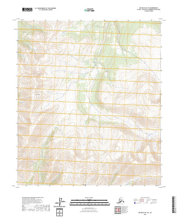
2024 Map of Big Delta B-1 SE
USGS Topo · Published 2024About this map
Black Mtn dominates the central-western portion of this Southeast Fairbanks quadrant, an area defined by steep drainages and several prominent creek systems. The landscape is carved by the headwaters of Antimony Creek and Summit Creek in the north, while Boulder Creek meanders through the central and southern valleys. These watercourses imply a rugged interior terrain where mineral exploration and backcountry travel are primary activities. The mapping of Johnson Creek and King Creek further illustrates the complex hydrological network typical of this Alaskan wilderness. This survey provides a modern snapshot of the region's topography, useful for tracing water drainage patterns and identifying high-altitude landmarks in a remote section of the state.
Find a feature on this map
12 named features on this map. Tap any name to fly to it.
Don’t see what you’re looking for? This feature index may not catch every label — zoom into the map to look around manually.
Map Details
Editions of this 2024 Big Delta B-1 SE Map
This is the sole edition of this map. No revisions or reprints were ever made.
Other maps of this area

1950 · Big Delta
USGS Topo · 1:250,000

1951 · Big Delta
USGS Topo · 1:250,000

1951 · Eagle
USGS Topo · 1:250,000

1955 · Big Delta A-1
USGS Topo · 1:63,360

1956 · Eagle A-6
USGS Topo · 1:63,360

1956 · Eagle B-6
USGS Topo · 1:63,360

1957 · Eagle
USGS Topo · 1:250,000

1958 · Big Delta B-1
USGS Topo · 1:63,360

1958 · Big Delta
USGS Topo · 1:250,000
2018 · Big Delta B-1 SW
USGS Topo · 1:25,000