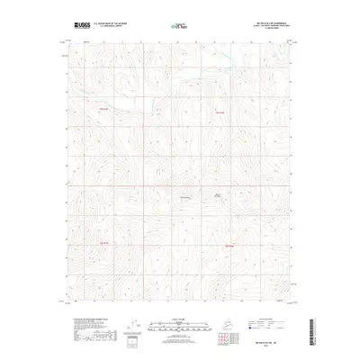
2018 Map of Big Delta B-2 NE
USGS Topo · Published 2018About this map
Goodpaster River winds through the northern portion of this interior Alaska wilderness, serving as the primary drainage for the surrounding high-elevation terrain. This 2018 survey documents the geography of the Mertie Mountains and the prominent Shawnee Peak, illustrating a landscape defined by sharp elevation changes and glacial runoff. The intricate contour work reveals the hydrological patterns of several tributaries, including Glacier Cr and Sonora Cr, as they descend toward the river valley. The map provides a precise record of the Southeast Fairbanks Census Area before modern development, detailing the remote township and range boundaries of t5s r15e and t5s r16e in an area where natural landmarks remain the primary points of orientation.
Find a feature on this map
9 named features on this map. Tap any name to fly to it.
Don’t see what you’re looking for? This feature index may not catch every label — zoom into the map to look around manually.
Map Details
Editions of this 2018 Big Delta B-2 NE Map
This is the sole edition of this map. No revisions or reprints were ever made.
Other maps of this area

1950 · Big Delta
USGS Topo · 1:250,000

1951 · Big Delta
USGS Topo · 1:250,000

1958 · Big Delta B-2
USGS Topo · 1:63,360

1958 · Big Delta B-1
USGS Topo · 1:63,360

1958 · Big Delta C-2
USGS Topo · 1:63,360

1958 · Big Delta C-1
USGS Topo · 1:63,360

1958 · Big Delta
USGS Topo · 1:250,000
2018 · Big Delta B-1 SW
USGS Topo · 1:25,000
2018 · Big Delta B-2 SE
USGS Topo · 1:25,000
2018 · Big Delta C-2 SE
USGS Topo · 1:25,000