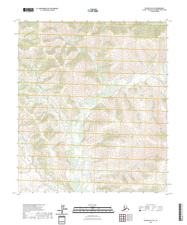
2024 Map of Big Delta B-3 SE
USGS Topo · Published 2024About this map
The Goodpaster River meanders through the heart of this interior Alaskan landscape, serving as the primary drainage for several significant tributaries. In this largely unpopulated region of the Southeast Fairbanks Census Area, the waterway creates a complex network of seasonal wetlands and riparian corridors. To the north, Sevenmile Creek flows into the valley, while the central portion of the sheet is defined by the convergence of Tenmile Creek and the river. To the south, Sand Creek enters the drainage, illustrating a topographical pattern where high-elevation ridges drop sharply into broad, water-carved basins. The absence of roads or established settlements emphasizes the wilderness character of the terrain during this modern survey period, where the landscape is defined almost entirely by its hydrography and the underlying Public Land Survey System grid.
Find a feature on this map
10 named features on this map. Tap any name to fly to it.
Don’t see what you’re looking for? This feature index may not catch every label — zoom into the map to look around manually.
Map Details
Editions of this 2024 Big Delta B-3 SE Map
This is the sole edition of this map. No revisions or reprints were ever made.
Other maps of this area

1950 · Big Delta
USGS Topo · 1:250,000

1951 · Big Delta
USGS Topo · 1:250,000

1954 · Big Delta A-2
USGS Topo · 1:63,360

1955 · Big Delta A-3
USGS Topo · 1:63,360

1955 · Big Delta A-2
USGS Topo · 1:63,360

1958 · Big Delta B-3
USGS Topo · 1:63,360

1958 · Big Delta B-2
USGS Topo · 1:63,360

1958 · Big Delta
USGS Topo · 1:250,000
2016 · Big Delta B-3 SE
USGS Topo · 1:25,000
2016 · Big Delta A-3 NW
USGS Topo · 1:25,000