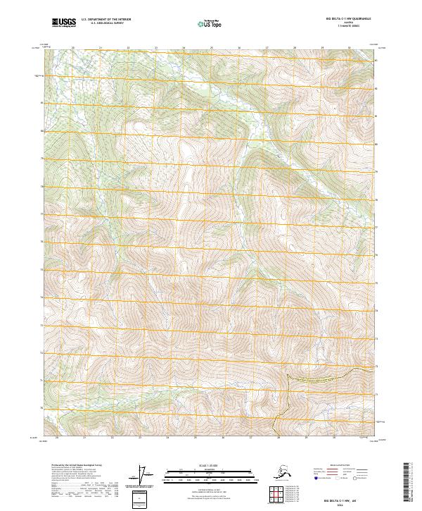
2024 Map of Big Delta C-1 NW
USGS Topo · Published 2024About this map
Stone Boy Creek flows through the high interior of Alaska, carving a path through the steep, mountainous terrain that defines this region. The landscape is characterized by significant elevation changes, where the drainages of the Slate Creek watershed meet the northern boundaries of the Fairbanks North Star Borough Southeast Fairbanks Census Area. This 2024 edition provides a high-resolution view of the local topography, capturing the precise contour of the ridges and valleys that have long shaped navigation and seasonal movement in this part of the state.
Find a feature on this map
3 named features on this map. Tap any name to fly to it.
Don’t see what you’re looking for? This feature index may not catch every label — zoom into the map to look around manually.
Map Details
Editions of this 2024 Big Delta C-1 NW Map
This is the sole edition of this map. No revisions or reprints were ever made.
Other maps of this area

1950 · Big Delta
USGS Topo · 1:250,000

1951 · Big Delta
USGS Topo · 1:250,000

1958 · Big Delta D-2
USGS Topo · 1:63,360

1958 · Big Delta D-1
USGS Topo · 1:63,360

1958 · Big Delta C-2
USGS Topo · 1:63,360

1958 · Big Delta C-1
USGS Topo · 1:63,360

1958 · Big Delta
USGS Topo · 1:250,000
2018 · Big Delta C-1 NW
USGS Topo · 1:25,000
2018 · Big Delta C-1 SE
USGS Topo · 1:25,000
2018 · Big Delta C-2 NE
USGS Topo · 1:25,000