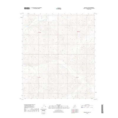
2018 Map of Big Delta C-2 NE
USGS Topo · Published 2018About this map
The Salcha River meanders through the northern reaches of this Fairbanks North Star region, cutting a distinct path through the high-elevation terrain. This 2018 survey highlights the isolation of the Alaskan interior, where the landscape is defined by drainage patterns rather than human infrastructure. In the southern half of the quadrangle, Porcupine Cr winds between steep ridges, illustrating the natural watercourses that have historically guided exploration and seasonal transit in this part of Alaska. Without roads or permanent settlements printed on the sheet, the map serves as a primary reference for the topography within the Public Land Survey System townships of t2s r15e, t2s r16e, t3s r15e, and t3s r16e.
Find a feature on this map
6 named features on this map. Tap any name to fly to it.
Don’t see what you’re looking for? This feature index may not catch every label — zoom into the map to look around manually.
Map Details
Editions of this 2018 Big Delta C-2 NE Map
This is the sole edition of this map. No revisions or reprints were ever made.
Other maps of this area

1950 · Big Delta
USGS Topo · 1:250,000

1951 · Big Delta
USGS Topo · 1:250,000

1958 · Big Delta D-2
USGS Topo · 1:63,360

1958 · Big Delta D-1
USGS Topo · 1:63,360

1958 · Big Delta C-2
USGS Topo · 1:63,360

1958 · Big Delta C-1
USGS Topo · 1:63,360

1958 · Big Delta
USGS Topo · 1:250,000
2018 · Big Delta D-2 SW
USGS Topo · 1:25,000
2018 · Big Delta C-1 NW
USGS Topo · 1:25,000
2018 · Big Delta C-2 SE
USGS Topo · 1:25,000