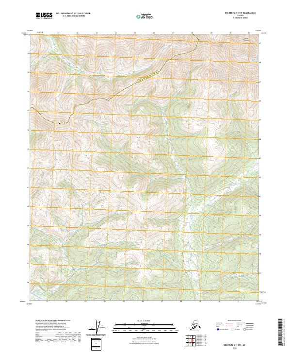
2024 Map of Big Delta C-1 SW
USGS Topo · Published 2024About this map
Goodpaster River winds through the southwestern corner of this interior Alaskan landscape, a region defined by its complex drainage systems and the elevated peaks of the Mertie Mountains. The geography is dominated by a series of steep drainages, including Porcupine Creek in the north and the extensive reach of Slate Creek as it descends through the eastern sections. This area marks a political boundary where the Fairbanks North Star Borough meets the Southeast Fairbanks Census Area. The lack of established roads or settlements highlights the isolation of this terrain, where the primary landmarks are the natural watercourses like Rock Creek and the high topographical relief of the surrounding mountains.
Find a feature on this map
13 named features on this map. Tap any name to fly to it.
Don’t see what you’re looking for? This feature index may not catch every label — zoom into the map to look around manually.
Map Details
Editions of this 2024 Big Delta C-1 SW Map
This is the sole edition of this map. No revisions or reprints were ever made.
Other maps of this area

1950 · Big Delta
USGS Topo · 1:250,000

1951 · Big Delta
USGS Topo · 1:250,000

1958 · Big Delta B-2
USGS Topo · 1:63,360

1958 · Big Delta B-1
USGS Topo · 1:63,360

1958 · Big Delta C-2
USGS Topo · 1:63,360

1958 · Big Delta C-1
USGS Topo · 1:63,360

1958 · Big Delta
USGS Topo · 1:250,000
2018 · Big Delta C-1 NW
USGS Topo · 1:25,000
2018 · Big Delta C-1 SE
USGS Topo · 1:25,000
2018 · Big Delta C-2 NE
USGS Topo · 1:25,000