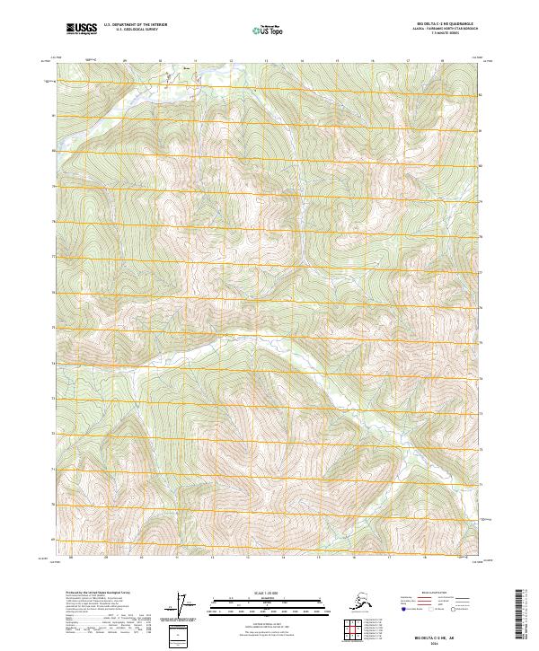
2024 Map of Big Delta C-2 NE
USGS Topo · Published 2024About this map
The Salcha River dominates the northern corner of this landscape, its path cutting through the high country of the Fairbanks North Star Borough. This 2024 map documents a largely unsettled interior where topographic relief and water drainage define the character of the land. Further south, the multiple branches of Porcupine Creek weave through steep valleys, illustrating the complex hydrology typical of this subarctic region. The map is organized by the Public Land Survey System, showing sections within townships t2s r15e, t2s r16e, t3s r15e, and t3s r16e. With no named settlements or roads printed on the sheet, the map serves as a detailed record of natural terrain and watercourses in their modern state.
Find a feature on this map
6 named features on this map. Tap any name to fly to it.
Don’t see what you’re looking for? This feature index may not catch every label — zoom into the map to look around manually.
Map Details
Editions of this 2024 Big Delta C-2 NE Map
This is the sole edition of this map. No revisions or reprints were ever made.
Other maps of this area

1950 · Big Delta
USGS Topo · 1:250,000

1951 · Big Delta
USGS Topo · 1:250,000

1958 · Big Delta D-2
USGS Topo · 1:63,360

1958 · Big Delta D-1
USGS Topo · 1:63,360

1958 · Big Delta C-2
USGS Topo · 1:63,360

1958 · Big Delta C-1
USGS Topo · 1:63,360

1958 · Big Delta
USGS Topo · 1:250,000
2018 · Big Delta D-2 SW
USGS Topo · 1:25,000
2018 · Big Delta C-1 NW
USGS Topo · 1:25,000
2018 · Big Delta C-2 NE
USGS Topo · 1:25,000