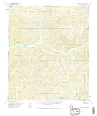
1958 Map of Big Delta C-3
USGS Topo · Published 1968About this map
The North Fork Salcha River and South Fork Salcha River converge in this mid-century survey of the Alaskan interior, forming the main stem of the Salcha River at a location identified as The Splits. The northern portion of the landscape is dominated by a large Military Reservation, while the southern reaches are bisected by the Fairbanks North Star Borough Boundary.
Find a feature on this map
16 named features on this map. Tap any name to fly to it.
Don’t see what you’re looking for? This feature index may not catch every label — zoom into the map to look around manually.
Map Details
Editions of this 1958 Big Delta C-3 Map
3 editions found
Other maps of this area

1950 · Big Delta
USGS Topo · 1:250,000

1950 · Big Delta B-4
USGS Topo · 1:63,360

1951 · Big Delta
USGS Topo · 1:250,000

1953 · Big Delta B-4
USGS Topo · 1:63,360

1958 · Big Delta C-4
USGS Topo · 1:63,360

1958 · Big Delta D-4
USGS Topo · 1:63,360

1958 · Big Delta B-3
USGS Topo · 1:63,360

1958 · Big Delta C-3
USGS Topo · 1:63,360

1958 · Big Delta D-3
USGS Topo · 1:63,360

1958 · Big Delta B-2
USGS Topo · 1:63,360