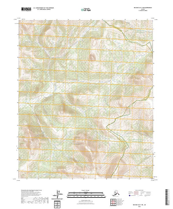
2024 Map of Big Delta D-1 NE
USGS Topo · Published 2024About this map
Yukon-Charley Rivers National Preserve encompasses the northeast and southeast corners of this quadrangle, representing a protected wilderness landscape at the intersection of the Fairbanks North Star Borough and the Yukon-Koyukuk Census Area. The interior terrain is defined by a series of drainages, including the headwaters of Cottonwood Creek in the northwest and Lost Creek moving through the central sections. In the southern reaches, Serpentine Creek winds through the topography, illustrating the complex hydrology of the Alaskan interior.
Find a feature on this map
10 named features on this map. Tap any name to fly to it.
Don’t see what you’re looking for? This feature index may not catch every label — zoom into the map to look around manually.
Map Details
Editions of this 2024 Big Delta D-1 NE Map
This is the sole edition of this map. No revisions or reprints were ever made.
Other maps of this area

1950 · Big Delta
USGS Topo · 1:250,000

1951 · Big Delta
USGS Topo · 1:250,000

1951 · Charley River
USGS Topo · 1:250,000

1951 · Eagle
USGS Topo · 1:250,000

1951 · Circle
USGS Topo · 1:250,000

1955 · Circle A-1
USGS Topo · 1:63,360

1955 · Circle
USGS Topo · 1:250,000

1956 · Charley River A-6
USGS Topo · 1:63,360

1956 · Charley River
USGS Topo · 1:250,000
1956 · Eagle D-6
USGS Topo · 1:63,360