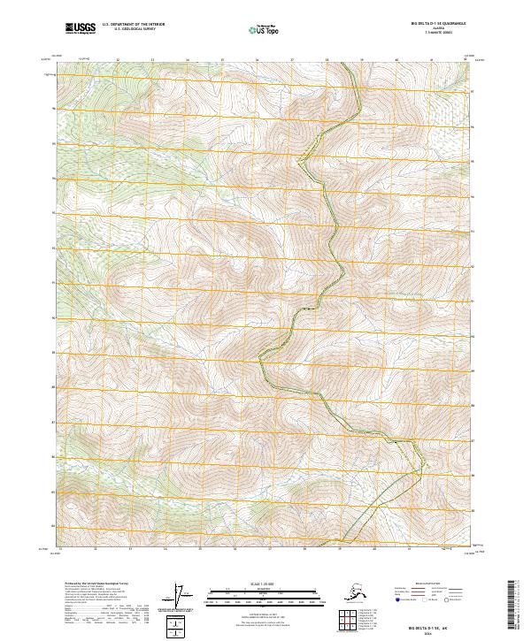
2024 Map of Big Delta D-1 SE
USGS Topo · Published 2024About this map
Fairbanks North Star Borough and the Yukon-Charley Rivers National Preserve converge in this high-latitude survey, marking a significant administrative boundary in the Alaskan interior. The landscape is defined by the drainage of Serpentine Creek, which flows through the northwestern portion of the map. This area remains largely undeveloped, preserving the original terrain and hydrography as they existed in the early 21st century. The map provides a precise look at the township and range lines, including t1n r17e and t1n r18e, which dictate the legal geometry of this wilderness. For researchers, the intersection of the census area and the national preserve boundary offers a clear study of how protected federal lands meet regional borough jurisdictions in a remote subarctic environment.
Find a feature on this map
11 named features on this map. Tap any name to fly to it.
Don’t see what you’re looking for? This feature index may not catch every label — zoom into the map to look around manually.
Map Details
Editions of this 2024 Big Delta D-1 SE Map
This is the sole edition of this map. No revisions or reprints were ever made.
Other maps of this area

1950 · Big Delta
USGS Topo · 1:250,000

1951 · Big Delta
USGS Topo · 1:250,000

1951 · Eagle
USGS Topo · 1:250,000

1956 · Eagle C-6
USGS Topo · 1:63,360
1956 · Eagle D-6
USGS Topo · 1:63,360

1957 · Eagle
USGS Topo · 1:250,000

1958 · Big Delta D-1
USGS Topo · 1:63,360

1958 · Big Delta C-1
USGS Topo · 1:63,360

1958 · Big Delta
USGS Topo · 1:250,000
2018 · Big Delta D-1 NW
USGS Topo · 1:25,000