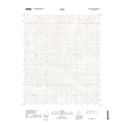
2018 Map of Big Delta D-1 SW
USGS Topo · Published 2018About this map
The Mertie Mountains dominate the high-elevation landscape of this Interior Alaska region, defining the headwaters of several significant drainages. The Salcha River cuts through the northwest corner of the quadrangle, serving as the primary waterway for a complex network of seasonal and perennial streams. Water movement is the central theme of this terrain, with the Serpentine Cr and Paldo Cr winding through deeply incised valleys before joining larger systems. Further south, Stone Boy Cr and Lost Cr trace their paths through the unpopulated wilderness. This 2018 survey illustrates the raw topography of the Fairbanks North Star Borough, where the absence of roads or permanent structures underscores the isolation of the Alaskan interior and the dominance of natural geographic boundaries.
Find a feature on this map
12 named features on this map. Tap any name to fly to it.
Don’t see what you’re looking for? This feature index may not catch every label — zoom into the map to look around manually.
Map Details
Editions of this 2018 Big Delta D-1 SW Map
This is the sole edition of this map. No revisions or reprints were ever made.
Other maps of this area

1950 · Big Delta
USGS Topo · 1:250,000

1951 · Big Delta
USGS Topo · 1:250,000

1958 · Big Delta D-2
USGS Topo · 1:63,360

1958 · Big Delta D-1
USGS Topo · 1:63,360

1958 · Big Delta C-2
USGS Topo · 1:63,360

1958 · Big Delta C-1
USGS Topo · 1:63,360

1958 · Big Delta
USGS Topo · 1:250,000
2018 · Big Delta D-2 NE
USGS Topo · 1:25,000
2018 · Big Delta D-1 NW
USGS Topo · 1:25,000
2018 · Big Delta C-1 NW
USGS Topo · 1:25,000