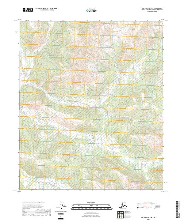
2024 Map of Big Delta D-1 SW
USGS Topo · Published 2024About this map
The Salcha River flows through the northwest corner of this Interior Alaska landscape, where high-elevation terrain is defined by the Mertie Mountains in the northeast. This 2024 survey captures a wilderness characterized by a complex drainage network that includes Serpentine Creek, which winds centrally through the quadrangle, and Paldo Creek further south. The map provides a contemporary record of the land within the Fairbanks North Star Borough, illustrating the intricate contour of the upland ridges and the lower creek basins like Stone Boy Creek and Lost Creek. This area remains largely dominated by its natural hydrology and topographic relief, with little in the way of developed infrastructure, serving as a primary reference for the physical geography of the Tanana Valley watershed.
Find a feature on this map
12 named features on this map. Tap any name to fly to it.
Don’t see what you’re looking for? This feature index may not catch every label — zoom into the map to look around manually.
Map Details
Editions of this 2024 Big Delta D-1 SW Map
This is the sole edition of this map. No revisions or reprints were ever made.
Other maps of this area

1950 · Big Delta
USGS Topo · 1:250,000

1951 · Big Delta
USGS Topo · 1:250,000

1958 · Big Delta D-2
USGS Topo · 1:63,360

1958 · Big Delta D-1
USGS Topo · 1:63,360

1958 · Big Delta C-2
USGS Topo · 1:63,360

1958 · Big Delta C-1
USGS Topo · 1:63,360

1958 · Big Delta
USGS Topo · 1:250,000
2018 · Big Delta D-2 NE
USGS Topo · 1:25,000
2018 · Big Delta D-1 NW
USGS Topo · 1:25,000
2018 · Big Delta C-1 NW
USGS Topo · 1:25,000