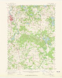
1958 Map of Big Rapids
USGS Topo · Published 1965About this map
The Muskegon River serves as the central artery for this mid-century portrait of West-Central Michigan, where the city of Big Rapids sits at a critical junction of river power and rail transport. The presence of the Ferris Institute and the Pennsylvania railroad line highlights the town's role as a regional hub for education and commerce. To the south, the river is harnessed by the Rogers Dam and Rogers Pond, signaling the area's development for utility and industry.
Find a feature on this map
98 named features on this map. Tap any name to fly to it.
Don’t see what you’re looking for? This feature index may not catch every label — zoom into the map to look around manually.
Map Details
Editions of this 1958 Big Rapids Map
3 editions found
Other maps of this area

1954 · Midland
USGS Topo · 1:250,000

1958 · Midland
USGS Topo · 1:250,000

1958 · Sand Lake
USGS Topo · 1:62,500

1958 · Woodville
USGS Topo · 1:62,500

1958 · Big Rapids
USGS Topo · 1:62,500

1959 · Midland
USGS Topo · 1:250,000

1959 · Howard City
USGS Topo · 1:62,500

1959 · Lake
USGS Topo · 1:62,500

1959 · Evart
USGS Topo · 1:62,500

1959 · Reed City
USGS Topo · 1:62,500