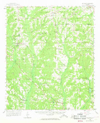
1959 Map of Billingsley
USGS Topo · Published 1968About this map
Billingsley and the rural crossroads of central Alabama are captured here during a period of steady agrarian life, just as modern communications were arriving. The Gulf Mobile and Ohio railroad cuts a diagonal path through the landscape, linking settlements like Vida Junction and Joffre. This rail corridor was the lifeblood for local commerce, connecting the timber-rich areas around Little Mulberry Creek to larger markets.
Find a feature on this map
85 named features on this map. Tap any name to fly to it.
Don’t see what you’re looking for? This feature index may not catch every label — zoom into the map to look around manually.
Map Details
Editions of this 1959 Billingsley Map
3 editions found

Other maps of this area

1891 · Clanton
USGS Topo · 1:125,000

1901 · Wetumpka
USGS Topo · 1:125,000

1903 · Wetumpka
USGS Topo · 1:125,000

1927 · Montgomery
USGS Topo · 1:48,000

1930 · Montgomery
USGS Topo · 1:62,500

1953 · Montgomery
USGS Topo · 1:250,000

1956 · Montgomery
USGS Topo · 1:250,000

1957 · Montgomery
USGS Topo · 1:250,000

1957 · Autaugaville
USGS Topo · 1:62,500

1957 · Benton
USGS Topo · 1:62,500