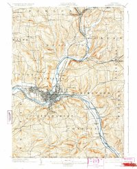
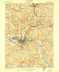
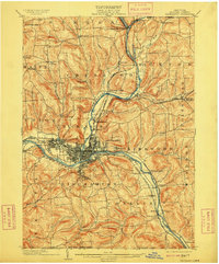
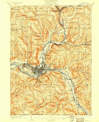
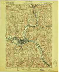
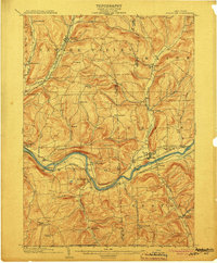
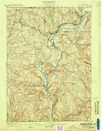
1904 Map of Binghamton
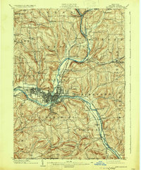
USGS Topo · Published 1931About this map
Binghamton serves as the industrial and transit focal point where the Susquehanna River and Chenango River converge. At the turn of the century, this landscape was defined by an extensive rail network, including the Erie R.R. and the Delaware Lackawanna and Western R.R., which funneled commerce through river-side hubs like Port Dickinson and Lestershire. The map reveals the intricate development of the city grid alongside recreational and civic landmarks such as Ross Park and the large Hospital complex to the east.
Find a feature on this map
72 named features on this map. Tap any name to fly to it.
Don’t see what you’re looking for? This feature index may not catch every label — zoom into the map to look around manually.
Map Details
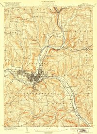
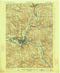
Editions of this 1904 Binghamton Map
9 editions found
Other maps of this area

1901 · Apalachin
USGS Topo · 1:62,500

1902 · Coventry
USGS Topo · 1:62,500

1903 · Harford
USGS Topo · 1:62,500

1904 · Binghamton
USGS Topo · 1:62,500

1904 · Greene
USGS Topo · 1:62,500

1904 · Oxford
USGS Topo · 1:62,500
1904 · Apalachin
USGS Topo · 1:62,500
1905 · Nineveh
USGS Topo · 1:62,500

1906 · Catatonk
USGS Topo · 1:125,000

1932 · Susquehanna
USGS Topo · 1:62,500