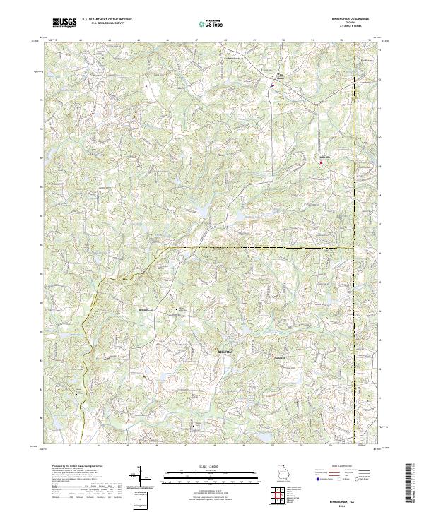
2024 Map of Birmingham
USGS Topo · Published 2024About this map
Lathemtown and Free Home anchor the northern reaches of this landscape, where the rolling terrain of Cherokee County meets the modern growth of northern Fulton and Forsyth. This survey illustrates a complex network of residential development intertwined with older crossroads communities like Holbrook and Birmingham. The geography is defined by a dense system of small lakes and creeks, including Little River, Chicken Creek, and Stephens Lake, which have historically shaped the settlement patterns of these foothills. For those tracing family history, the map preserves the locations of several small burial grounds such as Smith Cem, Stevens Cem, and Milton Fields Cem. The presence of landmarks like Iron Mountain and the transition between Milton and Hopewell highlights the shifting character of this region as it balances its rural origins with expanding suburban infrastructure.
Find a feature on this map
45 named features on this map. Tap any name to fly to it.
Don’t see what you’re looking for? This feature index may not catch every label — zoom into the map to look around manually.
Map Details
Editions of this 2024 Birmingham Map
This is the sole edition of this map. No revisions or reprints were ever made.
Other maps of this area

1890 · Suwanee
USGS Topo · 1:125,000

1894 · Suwanee
USGS Topo · 1:125,000

1926 · Tate
USGS Topo · 1:62,500

1928 · Tate
USGS Topo · 1:62,500

1955 · Rome
USGS Topo · 1:250,000

1956 · Duluth
USGS Topo · 1:24,000
1956 · Mountain Park
USGS Topo · 1:24,000

1956 · Roswell
USGS Topo · 1:24,000

1956 · Birmingham
USGS Topo · 1:24,000

1958 · Rome
USGS Topo · 1:250,000