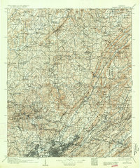
1907 Map of Birmingham
USGS Topo · Published 1934About this map
Industrial expansion and rugged topography meet at the foot of Red Mountain in this early twentieth-century survey of the Alabama coalfields. The map documents a landscape defined by the winding paths of the Mulberry Fork Warrior River and the Locust Fork, where mining operations like Watts Mines and Coalburg are connected to the wider world by the Louisville and Nashville RR and the Southern RR. These rail lines weave through narrow gaps in the ridges, such as Reid Gap and Morrow Gap, tracing the path of the region's mineral wealth.
Find a feature on this map
140 named features on this map. Tap any name to fly to it.
Don’t see what you’re looking for? This feature index may not catch every label — zoom into the map to look around manually.
Map Details
Editions of this 1907 Birmingham Map
5 editions found

Other maps of this area

1885 · Gadsden
USGS Topo · 1:125,000

1888 · Cullman
USGS Topo · 1:125,000

1888 · Gadsden
USGS Topo · 1:125,000

1889 · Springville
USGS Topo · 1:125,000

1889 · Birmingham
USGS Topo · 1:125,000

1890 · Bessemer
USGS Topo · 1:125,000

1890 · Talladega
USGS Topo · 1:125,000

1892 · Cullman
USGS Topo · 1:125,000

1892 · Birmingham
USGS Topo · 1:125,000

1892 · Springville
USGS Topo · 1:125,000