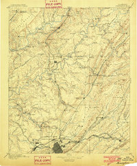
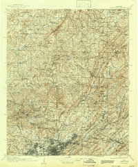
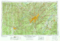
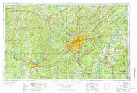
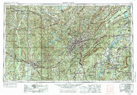
1953 Map of Birmingham
USGS Topo · Published 1964This historical map portrays the area of Birmingham in 1953, primarily covering Jefferson County as well as portions of Fayette County, Chilton County, Hale County, Clay County, Tallapoosa County, Lamar County, Tuscaloosa, Shelby County, Coosa County, Marion County, Calhoun County, Etowah County, Greene County, Winston County, St. Clair County, Cullman County, Bibb County, Talladega County, Walker County, Pickens County, and Blount County. Featuring a scale of 1:250000, this map provides a highly detailed snapshot of the terrain, roads, buildings, counties, and historical landmarks in the Birmingham region at the time. Published in 1964, it is one of 4 known editions of this map due to revisions or reprints.
Find a feature on this map
101 named features on this map. Tap any name to fly to it.
Don’t see what you’re looking for? This feature index may not catch every label — zoom into the map to look around manually.
Map Details
Editions of this 1953 Birmingham Map
4 editions found
Historical Maps of Taylorwood Estates Through Time
7 maps found