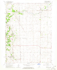
1964 Map of Bismarck
USGS Topo · Published 1965About this map
Bismarck and the surrounding borderlands of Vermilion County, Illinois, and Warren County, Indiana, are captured in the mid-1960s, showing a landscape defined by industrial rail lines and small farming communities. The Chicago and Eastern Illinois and Chicago Milwaukee St Paul and Pacific railroads intersect near Alvin (Alvan), reflecting the importance of transportation to the regional grain and gravel industries. Traces of older transit patterns are visible via the Old Railroad Grade cutting across the central township lines.
Find a feature on this map
24 named features on this map. Tap any name to fly to it.
Don’t see what you’re looking for? This feature index may not catch every label — zoom into the map to look around manually.
Map Details
Editions of this 1964 Bismarck Map
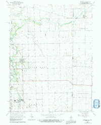
2 editions found
Other maps of this area

1899 · Danville
USGS Topo · 1:62,500

1900 · Danville
USGS Topo · 1:62,500

1933 · Hoopeston
USGS Topo · 1:48,000

1938 · Hoopeston
USGS Topo · 1:62,500

1948 · Danville NW
USGS Topo · 1:24,000

1950 · Danville NW
USGS Topo · 1:24,000

1950 · Danville NE
USGS Topo · 1:24,000

1951 · Danville NE
USGS Topo · 1:24,000

1953 · Danville
USGS Topo · 1:250,000

1955 · Danville
USGS Topo · 1:250,000